
Acknowledgements
UPDATE! The project has progressed thanks to funding and it has now a dedicated website showcasing two more maps: York and Oxford. London, York and Oxford maps have been created with new information and there are podcasts to dramatise interesting cases.
Visit https://medievalmurdermap.co.uk/ and enjoy more interactive maps, background information and podcasts. The original London map won't be updated. You can also follow the dedicated Twitter/X account of the new website at @MediMurderMaps.
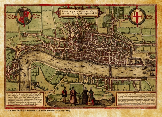
The Braun and Hogenberg map of London we used to create the Homicide Hotspots has been reproduced by kind permission of the Hebrew University of Jerusalem & the Jewish National & University Library. The map of London c.1270 has been reproduced by kind permission of the Historic Towns Trust.
We also wish to thank all our collaborators:
- Dr Michael Rice, Birgitte Bruun and Jeremy Ries helped with adapting the medieval texts.
- Ruth Schmid Eisner and Nora Eisner helped with the data preparation and geocoding.
 Sam Barnes at Design Monkey Media developed the
 software for producing the map and created the search index using Google Maps JavaScript API framework.
 Dan Gould of Dan Gould Design restored the image of the historical map
- Giles Darkes, Cartographic Editor, British Historic Towns Atlas, The Historic Towns Trust
Eisner, Manuel (2018). Interactive Medieval London Murder (Homicide) Map